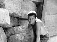
The site of the ancient city of Tauric Chersonesos is located on a large promontory between two bays, Karantinnaya (Russian for Quarantine) and Pesochnaya (Sandy) within the limits of the present-day city of Sevastopol. It covers the area of about 45 hectares. The investigations of the ancient city started in 1827 and continued throughout the nineteenth and twentieth century, with short intervals. By the early twenty-first century, the excavations have uncovered about one-third of the ancient city: defensive walls and towers, churches and public spaces like theater, water reservoir, the so-called mint, thermae (baths), etc. The most important result of the excavations in the ancient city is the discovery of the city layout according to Hippodamean plan: grid of residential quarters of the same size composed by parallel and perpendicular streets. Although modern division of the ancient city into areas is conventional, it is used in archaeological documents.
The division of the
ancient city into the areas is a convention; it is made for better orientation
of the visitors (real and virtual) in Chersonesos territory. This zoning is performed
according to existing tradition which is mentioned in scholarly and popular literature.
At the same time, we should mention that there still is a certain confusion as
to the numeration of longitudinal and transverse streets (and even of curtain
walls and residential quarters), so we have to follow more or less common
system of their designation.
|
|
 Report of 1974 restoration of the East Basilica. Text and illustrations Report of 1974 restoration of the East Basilica. Text and illustrations
(Year: 1974. Author: S. G. Ryzhov) |
|
Report of 1974 restoration of the East Basilica. Text and illustrations.
The East Basilica is located in the north-east area of the ancient city, in the end of the Main Street. It was excavated by the Odessa Society for History and Antiquities in 1877 and later investigated by R. Kh. Leper, in 1908.
The restoration was aimed at reconstructing the ground plan of the basilica using remaining parts of it and to show the masonry technique by raising the walls up to 1.3-1.5 m. The works were also organised in the cross church (mausileum?) that adjoins the basilica on the north.
|
|
|
Project of restoration of the square in front of the Eastern Basilica (with drawings and photos attached)
(Year: 1975. Author: M. I. Zolotaryov) |
|
The main street of the ancient city of Chersonesos finishes in the north-east with the sixth century church complex, the so-called East Basilica. Thjere also was a well-preserved pavement of a square. This pavement was constructed in the first centuries AD. It was the time when they constructed an arch in front of the entrance to the square from the Main Street. Next period of construction dates from the early mediaeval period. During this period (late-fifth and early-sixth century) the east Basilica was erected int he square. A nex construction was arranged after the tenth century, that of a residential complex and an altarless church.
We propose restoration works to reinforce stone masonries in quarters on either sides of the Main Street, to reconstruct stone slabs paving the square, and to reconstruct the East Basilica, which will allow one to include this area into the excursion.
|
|
|
Report of the Ural Team's excavations in Chersonesos in 1975
(Year: 1975. Author: Romanchuk A. I.) |
|
Report of the Ural State University Team's excavations in Chersonesos (Port area, south-east section) in 1975.
1975 excavations were the continuation of systematic works in the Port area, which the Joint Team started in 1963. The excavations were made by the students of the Historic Faculty of the Ural University under the supervision of the head of the Crimean Expedition candidate of history A. I. Romanchuk.
|
|
|
Album of illustrations of the Ural Team's excavations in Chersonesos in 1975
(Year: 1975. Author: Romanchuk A. I.) |
|
| Album of illustrations of the Ural Team's excavations in Chersonesos in 1975.
|
|
|
Report of the Ural State University's excavations in Chersonesos, in the Port Quarter, in its south-east area in 1974
(Year: 1974. Author: Romanchuk A. I.) |
|
1974 excavations were the continuation of systematic works in the
Port Area, which had been started by the Joined Team in 1963. In contrast to the previous years, they were made in one area only, in the south-east.
|
|
|
Album of illustrations to the report of the Ural State University's excavations in Chersonesos, in the Port Quarter, in its south-east area in 1974
(Year: 1974. Author: Romanchuk A. I.) |
|
| Illustrations to the report.
|
|
|
Report of the conservtion of the Arcosolia Church and album of illustrations
(Year: 1975. Author: S. G. Ryzhov) |
|
1963 excavations in the 'Port Area' of the ancient city of Chersonesos uncovered mediaeval quarter adjoining curtain walls 16 and 17 in the defensive wall. The area covered by ancient barracks included several mediaeval dwelling houses which open to a square in the south-east. The south-east side of the square was limited with the tenth-fourteenth century church, later known as the 'Arcosolia Church', because their walls had releiving archaes above ossuaty graves. During the period of excavations from 1963to 1970, the lower layers consisting of ground mound with cultural remains, above which the foundation of the church stood, were removed along the whole excavated area. In result, it turned out that the church stood above ground floors up to 1 m high, which greately collapsed due to climatic conditions.
|
|
|